Streets and geography
The Barclay Downs Charlotte Street Layout and Block Character
Explore the Barclay Downs Charlotte street layout, from mature tree canopies and lot configurations to how block character shifts across the neighborhood.
Few established enclaves in SouthPark possess a streetscape as cohesive and quietly layered as Barclay Downs Charlotte. Planned primarily throughout the mid-twentieth century across rolling Piedmont terrain, the neighborhood reflects a distinctive suburban design philosophy that prioritized generous setbacks, preserved natural drainage corridors, and an extensive canopy of mature hardwood trees. Rather than adhering to a rigid urban grid, the neighborhood unfolds through curving avenues, interconnected loops, and private cul-de-sacs that temper vehicular speeds and foster a distinctly secluded residential atmosphere.
Understanding the nuances of the Barclay Downs Charlotte street layout requires looking beyond the boundary lines on a map. From the wide, gently winding residential spines to the deep-set interior parcels bordering protected natural buffers, each quadrant of the neighborhood exhibits its own micro-geography, parcel geometry, and street-level character.
Topography and the Mid-Century Curvilinear Pattern
The geographic foundation of the neighborhood is characterized by undulating hills and gentle ridges. When developers initially platted the parcels, they followed the land's natural contours rather than imposing severe grading cuts. This approach preserved the dramatic grade changes that now give many streets their sense of privacy and separation from adjacent properties.
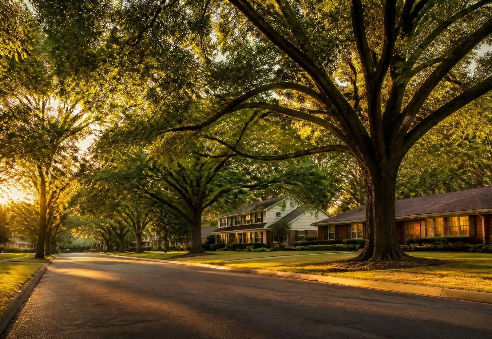
As detailed in our overview of the neighborhood location and boundaries, the streets gently weave across these elevated knolls. In many sections, the pavement transitions seamlessly into wide grassy shoulders and shallow roll-curbs beneath soaring willow oaks, native sweetgums, and established loblolly pines. The tree canopy serves as an organic ceiling, filtering sunlight during the summer months and creating a consistent, dignified street view across both historic mid-century ranches and newer architectural additions.
The Perimeter Corridors: Barclay Downs Drive and Runnymede Lane
The outer edges of Barclay Downs Charlotte establish clear physical boundaries while connecting residents directly to the broader SouthPark area. Along Barclay Downs Drive and Runnymede Lane, the streetscape takes on a slightly more formal, expansive presence. Lots along these main arteries often feature deeper front setbacks designed to buffer homes from passing traffic.
Navigating the local street directory reveals how these outer corridors function as navigational anchors. While these roads carry steady neighborhood traffic, their residential frontages remain heavily planted with evergreen hedges, low brick retaining walls, and mature flowering dogwoods. Properties along these thoroughfares often command substantial road frontage, allowing for broad front lawns and circular motor courts that complement the scale of expansive single-story and two-story homes.
Interior Enclaves and Quiet Residential Loops
Once you turn off the perimeter routes into the interior of Barclay Downs Charlotte, the ambiance changes dramatically. Interior streets such as Inverness Road, Canterbury Drive, and their surrounding offshoots are defined by calm residential rhythms. Because these roads do not function as thoroughfares between major commercial nodes, through-traffic is exceptionally rare.
Within these interior pockets, the relationship between the street and the home feels noticeably intimate. Broad front yards create open sightlines across adjacent properties, emphasizing a shared green landscape rather than segmented, walled-off lots. For property owners evaluating the nuanced differences between street tiers, advisors at Peters & Associates frequently note that interior loop positions often provide the strongest sense of quiet and localized community within the broader SouthPark market.
Key characteristics of these interior residential pockets include:
- Low-Speed Environments: The curvilinear street pattern naturally slows vehicular traffic without requiring artificial traffic-calming installations.
- Visual Continuity: Consistent mid-century building setbacks keep rooflines aligned in a balanced horizontal cadence.
- Interconnected Side Streets: Looping street networks allow residents to walk, run, and cycle through miles of quiet scenery without encountering major intersections.
Lot Geometry and Spatial Configuration
Parcel dimensions within the community differ noticeably from contemporary high-density subdivisions. Most original lots were platted with generous dimensions, typically measuring between eighty and one hundred and twenty feet in width and spanning one-third to more than one-half acre in total area.
This rectangular and wedge-shaped geometry directly informs how properties are lived in today. As explored throughout our guide to local luxury homes, wide street frontages afford ample space for lateral expansions, attached multi-car garages sited inconspicuously toward the rear, and generous side yards that maintain breathing room between structures. Backyards are frequently deep and private, backing up to natural tree buffers, seasonal creeks, or neighboring green spaces that provide exceptional outdoor living potential.
Pedestrian Connectivity and Micro-Pockets
While the neighborhood is celebrated for its peaceful residential streets, it also benefits from uncommon pedestrian connectivity to surrounding SouthPark amenities. The southern and eastern corners of the enclave sit within comfortable walking distance of central retail, dining, and educational institutions, creating a unique hybrid of quiet suburban life and pedestrian convenience.
Residents often utilize the neighborhood street network to access nearby parks and greenways, as well as community gathering points like the local swim and tennis facilities tucked discreetly between residential blocks. The experience of walking through the community is defined by constant visual variation—from flat, sunny stretches lined with classic mid-century split-levels to secluded, wooded cul-de-sacs that feel completely detached from the surrounding city.
This thoughtful balance of natural topography, mature arboreal canopy, and deliberate street planning is precisely what makes exploring the Barclay Downs neighborhood guide so compelling. By preserving its mid-century spatial character while accommodating tasteful modern renewal, the streetscape remains one of Charlotte's most timeless and enduring residential landscapes.
Answers
Frequently asked questions
What are the main thoroughfares bordering Barclay Downs?
Barclay Downs is bounded by several prominent SouthPark corridors, including Runnymede Lane to the northwest, Barclay Downs Drive to the east, and Fairview Road to the south. While these arterial roads provide direct access to retail and commercial centers, the interior residential streets are designed as curvilinear loops and quiet dead ends that naturally filter out non-local through-traffic.
How large are typical residential lots in Barclay Downs?
Most residential parcels in the neighborhood range from roughly one-third of an acre to just over a half-acre. These lots typically feature generous frontages, often spanning eighty to well over one hundred feet, which accommodates wide ranch profiles, expanded floor plans, and deep, private backyards shielded by mature hardwoods.
Are there sidewalks throughout the Barclay Downs street network?
Sidewalk coverage varies depending on the specific block. While major perimeter roads and corridors near neighborhood facilities offer dedicated sidewalks, many interior residential streets retain a traditional mid-century profile with wide asphalt paving, mature grass shoulders, and shallow curbing, creating a shared, low-speed environment for walking and cycling.
How does the topography vary across different parts of the neighborhood?
The neighborhood rests on gently undulating Piedmont terrain. Elevations rise toward central ridges before sloping downward toward local creek tributaries and natural drainage swales. This varied elevation creates distinctive vantage points, with some homes situated on elevated knolls while others enjoy private walkout basements nestled into gently sloping tree-lined grades.