Orientation
The neighborhood, precisely.
Boundaries, the street grid, the canopy, and the four roads that define daily life in Barclay Downs.
Barclay Downs is a subdivision, not a vague area name, and that matters when you are trying to buy here. The recorded plats run in phases from the late 1950s into the 1970s, and the grid they created is unusually legible: long east–west residential streets crossed by a handful of connectors, with almost no cul-de-sacs and very few dead ends.
The practical effect is that the interior of the neighborhood is quiet in a way that surprises people who only know SouthPark from the outside. Through traffic has better options — Sharon, Fairview, Colony and Barclay Downs Drive all move faster — so the streets inside the ring carry almost nothing but residents.
The canopy
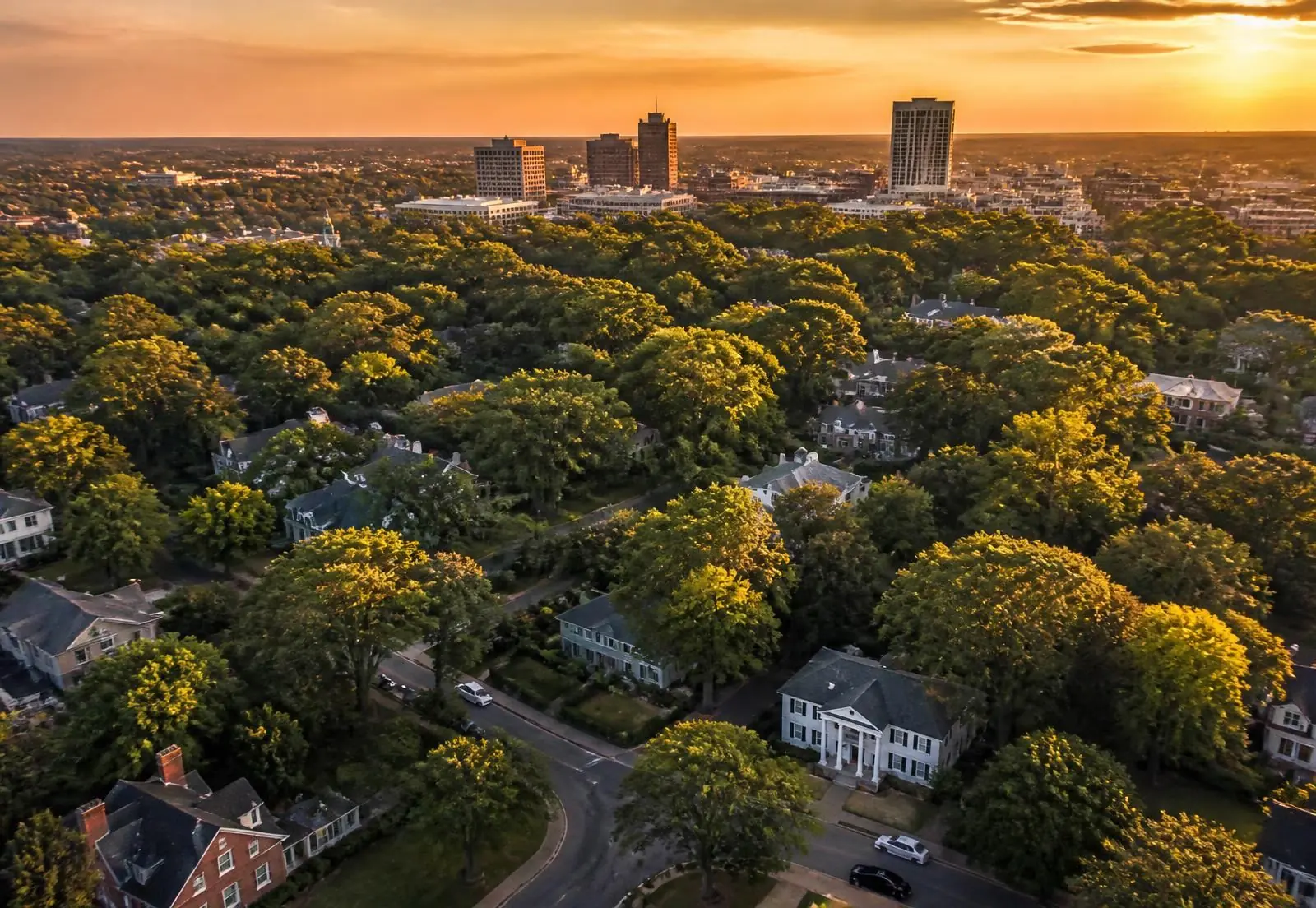
The single most valuable thing here was planted, not built. Willow oaks set along the curb strips when the neighborhood was young are now sixty-plus years old, and on the older streets they close overhead into a continuous green tunnel. It changes the temperature of a summer afternoon, it changes what a house looks like from the street, and it is the reason appraisals in the interior of Barclay Downs behave differently from the newer subdivisions further out.
It also creates obligations. Charlotte's tree ordinance and the city's heritage-tree protections mean that a mature willow oak on a lot you intend to redevelop is a design constraint, not an inconvenience to be removed. Every competent builder here starts with a tree survey.
How the grid is organized
Broadly, the neighborhood reads in three bands. The eastern streets nearest Barclay Downs Drive are the most walkable to SouthPark and carry the most new construction. The central band — Cloverfield, Beverwyck, Wickersham, Coltsgate and their neighbors — is the classic heart of the neighborhood: original ranches interleaved with heavy renovations. The western edge toward Colony Road blends into Morrocroft and Sharon Woods, with somewhat larger lots and a quieter, more separated feel.
- East band — highest walkability, strongest tear-down activity, closest to retail noise on Sharon Road.
- Central band — deepest canopy, most consistent streetscape, the streets people picture when they say "Barclay Downs".
- West band — larger and more irregular parcels, easy access to Colony Road and Morrocroft Village.
Getting anywhere
From the middle of the neighborhood: SouthPark Mall in three to five minutes, Phillips Place in four, Freedom Park in eight, uptown Charlotte in fifteen to twenty depending on the hour, and Charlotte Douglas International in about twenty via Billy Graham Parkway. That combination — a genuinely quiet street with a fifteen-minute commute to a major central business district and a twenty-minute drive to a global hub airport — is what people are actually paying for.
Explore the area
The map below plots the shopping districts, schools, parks, clubs, restaurants and transport anchors around Barclay Downs. Filter by category to see how the neighborhood sits inside south Charlotte.
Districts
Barclay Downs
Center
The residential grid itself — roughly 1,000 homes bounded by Fairview Road, Barclay Downs Drive, Sharon Road and Colony Road.
Browse 50 places
Answers
About the neighborhood
What are the boundaries of Barclay Downs?
+
Most residents describe Barclay Downs as the area bounded by Fairview Road on the north, Sharon Road on the south, Colony Road on the west, and Barclay Downs Drive and the SouthPark commercial core on the east. Real estate listings sometimes stretch the label to nearby pockets along Sharon View Road and Cameron Valley.
Is Barclay Downs part of SouthPark?
+
They are distinct but inseparable. SouthPark is a commercial district and a broader area name; Barclay Downs is a specific residential subdivision inside it. When people say they live in SouthPark, they very often mean Barclay Downs.
Does Barclay Downs have an HOA?
+
Barclay Downs is an older platted subdivision rather than a modern covenant-controlled community, and there is a voluntary neighborhood association rather than a mandatory HOA with dues and architectural review over the whole grid. Individual streets and later infill pockets can have their own recorded restrictions, so always review the recorded documents for a specific parcel.
Related Guides